FAQs
What is happening?
Greater Wellington is starting a future-focused review of the Lower Wairarapa Valley Development Scheme. This first stage of engagement is open from Monday 20 July to Sunday 9 August 2026 and is about letting the community know the review is beginning and asking people to share what they know about past flooding, environmental change and what they value about the area.
Why is Greater Wellington reviewing the scheme?
The scheme was built in the 1960s and a lot has changed since then, including land use, environmental conditions, Treaty settlement context and weather patterns. Greater Wellington needs to build a clearer information base before any future decisions are made about the scheme.
Are you making decisions about the scheme now?
No. This stage is about gathering information and building understanding. No decisions are being made through this engagement, and there are no options or proposals being consulted on at this stage.
What information are you asking for?
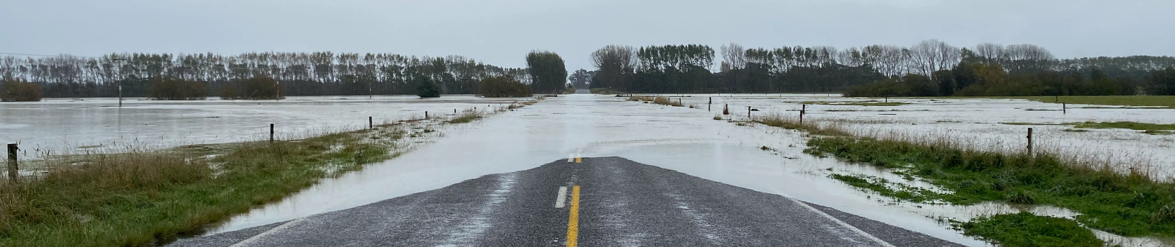
We’re asking people to share photos, videos, stories and observations about past flooding, especially from floods in 2004, 2006 and 2026. We’re also interested in environmental changes people have seen over time and what people value about the Lower Wairarapa Valley.
What area are you looking at in particular?
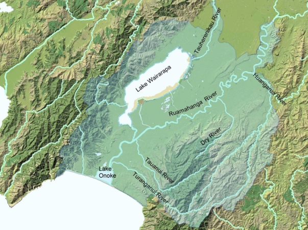
We are looking to collect information about floods and environmental changes in the Lower Wairarapa Valley. The Lower Valley area covers the Ruamāhanga River from the Waiohine confluence to the Lake Ōnoke outlet. Other major tributaries include the Tauwherenīkau draining from the western Tararua Ranges and the Huangarua, Tauanui and Tūranganui Rivers flowing from the eastern hills. It also includes both the Lakes and many of the smaller streams that flow into them on both the western and eastern sides.
Why do you want local knowledge?
Local knowledge helps us understand what has happened on the ground. Photos, stories and observations can help check and improve the information used in flood modelling, and can also help us understand what matters to people in the area.
What is flood hazard modelling?
Flood hazard modelling uses information such as rainfall, river flows, land levels, historic flood records and community observations to help estimate where flooding may happen. The modelling helps build a clearer picture of flood risk, but it works best when local knowledge is included.
What type of flooding are you interested in?
We’re interested in information about flooding across the Lower Wairarapa Valley that can help us understand how water moves through the catchment and how the current scheme performs. This may include river flooding, overland flow, lake or wetland edge changes, drainage issues, and observations about where floodwater has gone in past events.
How do I share information?
You can use the map tool on this page to mark a location and tell us what you know. You can also upload photos or other supporting information. If you would prefer to share information another way, you can contact Greater Wellington directly.
Can I submit photos or videos?
Yes. Photos are especially useful if they show where floodwater reached, how deep it was, or what areas were affected. Videos may also be useful. If the map tool does not support the type of file you want to share, please email floods@gw.govt.nz and we can advise the best way to provide it
What if I do not have photos?
You can still share what you remember. Written observations, stories, dates, locations, flood depths, flow paths and details about what was affected are all useful.
Why are you asking about environmental changes and values?
The review is not only about flood infrastructure. We also need to understand the wider catchment, including environmental, cultural, recreational, economic and community values. Information about changes people have seen over time will help us build a more complete picture of the area.
Will my feedback be public?
Feedback added to the map tool may be visible to other visitors to the page. Your personal details will be kept private. Please do not include private information in the public part of your submission.
How will Greater Wellington use my information?
We will use the information to help inform flood hazard modelling and the wider review of the Lower Wairarapa Valley Development Scheme. We may also contact you if we need to clarify details or better understand the information you provided.
Greater Wellington will collect, store, use and/or share your personal information in an anonymised and aggregated form in accordance with the Greater Wellington privacy statement.
Will this affect my insurance or property value?
This stage is about collecting information and starting the review. No new flood hazard maps are being released through this engagement. Insurance and property decisions are made by insurers, property owners and other parties. Greater Wellington’s role is to improve understanding of flood risk and share information clearly as the review progresses.
How does this relate to Donald’s Creek flood hazard mapping?
Flood hazard mapping for Donald’s and Abbott’s Creeks in the Featherston area has already been completed. The Lower Wairarapa Valley Development Scheme review is a wider piece of work. Where relevant, existing information from Donald’s and Abbott’s Creeks will be considered as part of the wider understanding of the Lower Valley.
What is happening with the Donald’s Creek flood hazard mapping?
We have completed modelling and are now looking at the potential costs and impacts associated to the flooding modelled. This will help inform us of any further management decisions for the area that may be incorporated as part of the wider scheme.
What happens after this stage?
Information gathered during this stage will be reviewed and used to help inform the next phases of work. There will be further opportunities to stay informed and be involved as the review and flood hazard modelling progress.
Who can I contact if I have questions?
If you have questions or need help sharing information, please contact Greater Wellington at floods@gw.govt.nz and mention the Lower Wairarapa Valley Development Scheme review.